Gis Applications
Advertisement

AvisMap GIS Engine
AvisMap GIS Engine is a comprehensive SDK for the development of custom GIS applications and solutions. This SDK provides several ActiveX (OCX) controls which support Visual Basic, VB.NET, C#, Visual C++ and other ActiveX compatible programming languages,
Advertisement
GeOxygene v.1.4
GeOxygene aims at providing an open framework which implements OGC/ISO specifications for the development and deployment of geographic (GIS) applications.
Canvas GIS Advanced (Mac) v.9.0.4
About Canvas GIS Advanced (Mac)Adds native support for Geographic Information System (GIS) data to Canvas.

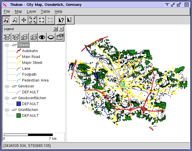
Thuban for Linux v.1.2.2
Thuban is an interactive geographic data viewer (GIS viewer) which features methods to visualize, explore, and analyze geographic information.
Thuban for Mac OS X 1.0.1-3 v.3
Thuban is an interactive geographic data viewer (GIS viewer) which features methods to visualize, explore, and analyze geographic information.
Thuban for Windows v.1.2.2
Thuban is an interactive geographic data viewer (GIS viewer) which features methods to visualize, explore, and analyze geographic information.

Icons-Land Vista Style POI Icon Set v.2.0
Vista Style Points of Interest Icon Set V2 can be used in Tourism and Entertainment industries, as it joins points of interest icons such as Restaurant, Bank, Hospital, etc. Being hand-crafted pixel by pixel all images are of capital quality.
Ruby
Ruby - This program will scan the users CDRs and then catalog and save the file properties (name, directory, attributes, size, date) and the disc properties (serial#, file system, volume label, # of files, user chosen description) onto a database. The
ARES Commander Edition v.10.11.207
Offering full ARES® functionality, ARES Commander Edition additionally integrates the ACIS 3D Solid Modeler. Also, it is fully programmable and customizable through common program languages.
KML Feature Extractor v.1.0.1
KML Feature Extractor is a program designed to extract the features of KML/KMZ files (the native format of Google Earth). The program will scan for features, extract them, and convert them to shapefiles.